The BORDER_ART group invites you to visit The Oder Island!


We are surrounded by maps.
To go somewhere, find something, to make sense of our environment, we are relying on maps. We believe that what we see on the map is existing “in reality”. But what if the map does not show what you are seeing around you? What if you found a secret, precious place that is there but also not there – that is visible and sometimes invisible?
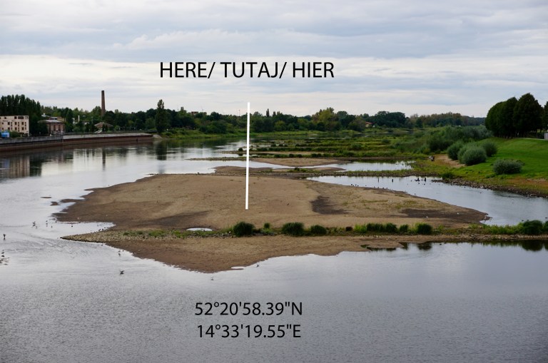
We discovered such a place in the Oder. An island that is uncovered but might again be covered by water soon.
Thus, we set ourselves the goal to creatively map the Oder Island!
Have you every tried drawing a map yourself? Equipped with pen and paper we spread out to map the island just to figure out that this is by no means an easy task!
Try to observe yourself from a bird’s perspective flying over the island. And then you start drawing the first careful lines. You look at the waves that blur the “borders” of the island. They come and go, they are guided by a multitude of streams and accompany you on the way around the island. After walking a few steps you realise that from this point the lines you were drawing look completely different from what you actually see. Your perspective has obviously changed…
While we started with mapping the spatial dimension of the island, this is not going to be the only one. We are convinced that the temporality of the Oder island makes this place unique. We want to use this precious moment of space and time to gather people and search for treasures on the island together!
Being aware that maps are never neutral or objective, we started a process of creating mapS of the Oder Island. We invite you to follow our process or come visit the Oder island yourself to discover, cover and uncover the in/visible.
Wir sind umgeben von Karten.
Wir benutzen Karten, um irgendwo hinzugehen, etwas zu finden, unsere Umgebung einzuordnen. Wir glauben, dass das, was wir auf der Karte sehen, auch “in echt” existiert. Aber was passiert, wenn die Karte nicht das abbildet, was Du um Dich herum siehst? Was passiert, wenn Du einen geheimnisvollen, wertvollen Ort gefunden hast, der da ist, aber auch nicht da – der sichtbar und manchmal unsichtbar ist?
Wir haben solch einen Ort entdeckt. Eine Insel mitten in der Oder, die unbedeckt ist, aber bald wieder von Wasser bedeckt sein kann.
Deshalb haben wir uns zum Ziel gesetzt, die Oder Insel kreativ zu kartieren!
Hast Du jemals versucht, selbst eine Karte zu erstellen? Ausgerüstet mit Stift und Papier sind wir auf der Insel ausgeschwärmt, nur um bald herauszufinden, dass dies wahrlich keine einfache Aufgabe ist!
Versuch, Dich aus der Perspektive eines Vogels zu beobachten, der über die Insel fliegt. Und dann beginnst Du, erste vorsichtige Linien zu zeichnen. Du schaust auf die Wellen, die die “Grenzen” der Insel verwischen. Sie kommen und gehen, sie werden von einer Vielzahl von Strömungen geleitet und begleiten Dich auf Deinem Weg um die Insel. Nachdem Du einige Schritte gegangen bist, realisierst Du, dass die Linien, die Du gezeichnet hast, von diesem Punkt aus komplett anders aussehen, als dass, was Du siehst. Deine Perspektive hat sich offensichtlich geändert…
Auch wenn wir damit begonnen haben, die räumliche Dimension der Insel zu kartieren, werden wir es nicht dabei belassen. Wir sind davon überzeugt, dass die Temporalität der Oder Insel diesen Ort einzigartig macht. Wir möchten diesen wertvollen Moment von Zeit und Ort nutzen, um Menschen zusammen zu bringen und gemeinsam nach Schätzen auf der Insel zu suchen.
In dem Bewusstsein, dass Karten niemals neutral oder objektiv sind, haben wir einen Prozess begonnen, Karten der Oder Insel zu erstellen. Wir laden Dich ein, unseren Prozess zu verfolgen oder die Insel selbst zu besuchen, um das Un/Sichtbare zu entdecken!
Jesteśmy otoczeni przez mapy.
Aby dokądkolwiek pójść, odnaleźć cokolwiek, czy też po prostu nadać sens naszemu otoczeniu odwołujemy się do map. Wierzymy, że to, co widzimy na mapie, istnieje „w rzeczywistości”. Lecz co, jeśli mapa nie pokazuje dokładnie tego, co widzimy dookoła siebie? Co, jeśli uda się nam odnaleźć sekretne miejsce, które z jednej strony istnieje, a jednocześnie go nie ma? Miejsce, które bywa widzialne, ale bywa, że ukrywa się przed naszym spojrzeniem?
Odkryliśmy takie miejsce na Odrze. Jest to wyspa, która wyłoniła się z wody, ale równie dobrze może być przez nią w każdej chwili ponownie zatopiona.
Dlatego właśnie postawiliśmy sobie za cel stworzenie kreatywnej mapy wyspy Odra!
Czy próbowaliście kiedykolwiek narysować mapę? Za pomocą ołówka i kartki papieru postarajcie się naszkicować mapę, co – jak się wkrótce okaże – wcale nie będzie łatwym zadaniem!
Spróbujcie spojrzeć na siebie z perspektywy ptaka lecącego nad wyspą. Zaraz potem zacznijcie ostrożnie nanosić pierwsze linie. Spoglądajcie na fale, które zamazują „granice” wyspy.
Kierowane przez niezliczone prądy fale nieustannie przypływają i odpływają. Na wyspie będą was one otaczać zewsząd. Po przejściu zaledwie kilku kroków zauważycie, że z nowego miejsca linie, które dotychczas nanieśliście, przedstawiają coś zupełnie innego, aniżeli to, co właśnie ukazuje się waszym oczom. Wasza perspektywa najprawdopodobniej ulegnie zmianie…
Mapowanie przestrzenne wyspy nie będzie jednak naszym jedynym zadaniem. Jesteśmy bowiem przekonani, że tymczasowość wyspy Odra czyni to miejsce unikalnym. Chcemy wykorzystać ten szczególny fragment czasu i przestrzeni, aby zabrać was na poszukiwanie skarbów, które ukryte są na wyspie.
Będąc świadomym, że mapy nigdy nie są ani neutralne, ani obiektywne, rozpoczęliśmy proces tworzenia wielu map wyspy Odra. Zapraszamy was zatem do przyłączenia się do nas i odwiedzenia wyspy Odra, by odkryć dla siebie to, co (nie)widzialne.
